SKYLINE AND PLOI POLI STATE PARK
https://hawaiitrails.hawaii.gov/trails/#/view-coas
YOU MUST PROVIDE ALL YOUR OWN TRANSPORTATION as there are no permits issued to any company provide any shuttle or guides!
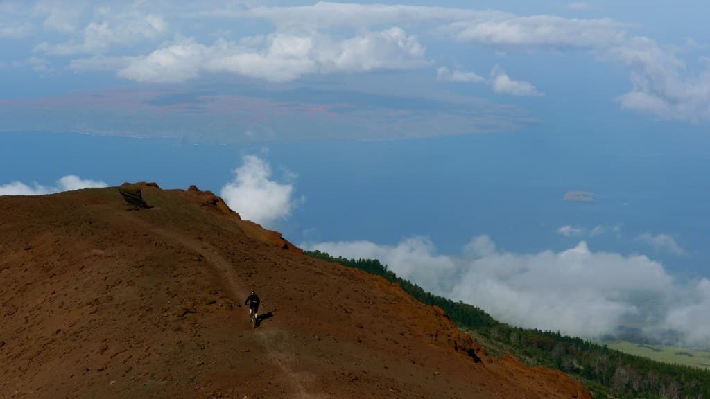
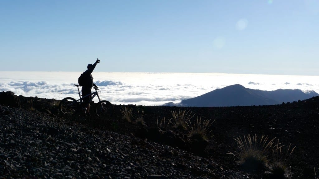
The Haleakala Maui Skyline Trail is known as one of the best downhill, point-to-point or out-and-back mountain bike rides on Maui. This is an off-road/off-pavement ride. Most visitors to Maui and want to bike down the volcano on the road, this IS NOT that kind of ride.
The trail is mostly above the treeline, there for the terrain is mostly volcanic rock dotted by a few small shrubs. The trail is rated as a moderately difficult, but offers unmatched views of Maui’s north and south shores as well as the valley below. When Riding from the top of Haleakala (10,023ft) to Rice Park, Kula the total ride is almost 7000ft of vertical and 17 miles long. Plan on around a 2-3 hr ride, 5 hrs from shop back to shop.
The Skyline trail begins 1.25 miles southwest of 10,023-foot summit of Haleakala. The trail travels approximately 6.8 miles and has an elevation change of 2,600 feet. Again, this is an out-and-back ride. The Haleakala Maui Skyline Trail can be ridden as an out-and-back trail or as part of a point-to-point epic ride. Below are the trails that can be accessed from the Maui Skyline Trail.
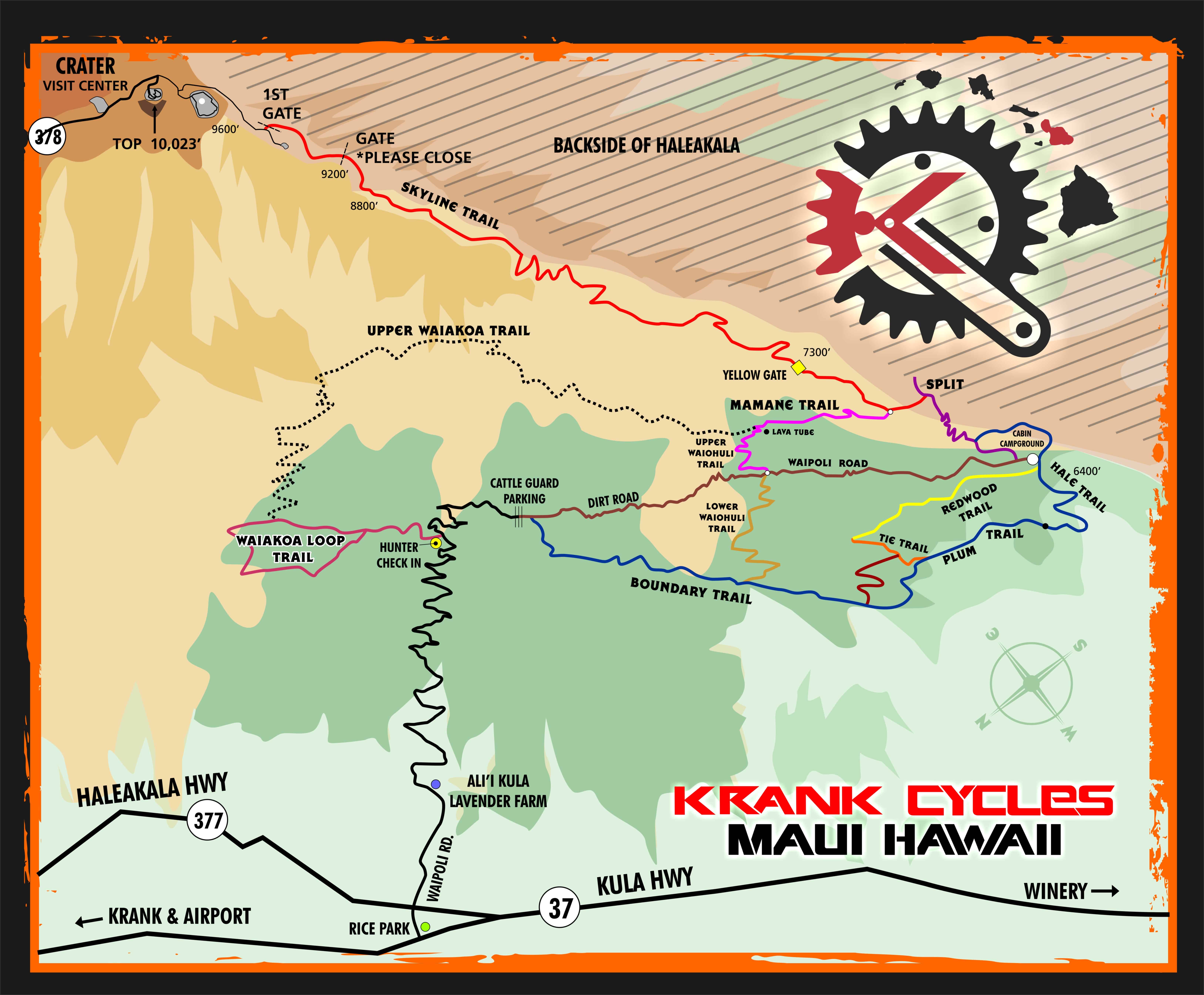
From the Haleakala Maui Skyline Trail you can also get the Mamane Trail’s upper trailhead. The trail’s lower trailhead can be accessed via the Kula Forest Reserve. The Mamane Trail is a 1.8 mile trail that’s good for most all skill levels. The terrain includes groves of mamane trees, shrubs and other sub-alpine vegetation. The elevation change is 520 feet.
The Mamane Trail can be connected with the Upper Waiohuli Trail. The Upper Waiohuli Trail is a 7-mile trail with a 1,200 elevation change. The trail passes through rugged terrain and mixed pines. There is also a natural cave along the Upper Waiohuli Trail. This is a difficult trail and might not be suitable for beginner riders.
The Upper Waiohuli Trail connects to the Waiakoa Loop Trail. This moderately difficult trail is approximately 3 miles with a 400-foot elevation change. The terrain includes a pine-tree forest, many switchbacks, and has excellent views in all directions. It is suggested that vehicles be parked below the hunter’s check-in station.
Getting to the Haleakala Maui Skyline Trail
From Krank Cycles in Makawao, take Makawao Avenue west to Highway 37. Turn left on Highway 37. Continue on Highway 37 to the juction of Highway 377 and turn left. Continue on Highway 377 and turn left onto Highway 378 to Haleakala National Park. The road will enter Haleakala National Park. Turn left just before the Red Hill Overlook and proceed to Science City. The road ends just past the Haleakala Maui Skyline Trail trailhead.
Getting to the Waiakoa Loop Trail
From Krank Cycles in Makawao, head west to Highway 37. Turn left on Highway 37. Turn left at the junction with Highway 377. Take Highway 377 for approximately 0.3 miles and turn right on Waipoli Road. Cross the first cattle guard and continue up the mountain to the hunter’s check-in station.